Alipur, Delhi
| Alipur | |
|---|---|
| Village | |
 Alipur Location in India | |
| Coordinates: 28°48′00″N 77°09′00″E / 28.80°N 77.150°ECoordinates: 28°48′00″N 77°09′00″E / 28.80°N 77.150°E | |
| Country |
|
| State | Delhi |
| District | North West |
| Elevation | 209 m (686 ft) |
| Population (2001) | |
| • Total | 16,623 |
| Languages | |
| • Official | Hindi, English |
| Time zone | UTC+5:30 (IST) |
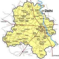
Alipur is a census town in North West district in the state of Delhi, India, surrounded by the localities of Bawana, Narela, Budhpur, Bakoli and Mukhmelpur. Alipur comes under the Narela constituency.Mr. Sharad Chauhan is the present MLA of Narela constituency. Nearest metro station is Jahangirpuri. Alipur situated on the Delhi to Chandigarh highway, The National Highway 1. Nisha Mann is the present Councilor at Municipal Corporation of Delhi and the Nigam Parshad of Alipur. Alipur Village have Many Facilities are Available like : Government Schools, Private Schools, Collage, SDM Office, Post Office, Mini Stadium, Nehru Yuva Kendra, Delhi Jal Board Office, Banks, City Forest, Holy Rama Mandir, Gold Loan Provider ( Muthoot Finance or Fincorp ), etc.
Demographics
As of 2001 India census,[1] Alipur had a population of 16,623. Males constitute 58% of the population and females, 42%. It has an average literacy rate of 68%, higher than the national average of 59.5%; 63% for males and 37% for females. 15% of the population is below 6 years of age.
References
- ↑ "Census of India 2001: Data from the 2001 Census, including cities, villages and towns (Provisional)". Census Commission of India. Archived from the original on 2004-06-16. Retrieved 2008-11-01.
External links