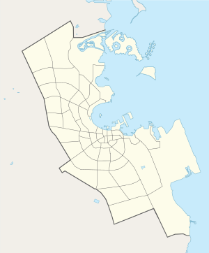
Al Markhiya
| Al Markhiya | |
|---|---|
| Settlement | |
 Al Markhiya | |
| Coordinates: 25°19′21″N 51°30′28″E / 25.32250°N 51.50778°ECoordinates: 25°19′21″N 51°30′28″E / 25.32250°N 51.50778°E | |
| Country | Qatar |
| Municipality | Doha |
| Area | |
| • Total | 2.7 km2 (1.0 sq mi) |
| Population | |
| • Total | 5,197 |
| • Density | 1,900/km2 (5,000/sq mi) |
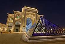
Al Markhiya is a neighborhood of Doha, Qatar. It is one of the later-developed areas of northern Doha. The district hosts three awsaq al-furjan complexes, which are part of a development project by the government to host all commercial establishments in centralized areas.[1]
History
In J.G. Lorimer's 1908 geography section of the Gazetteer of the Persian Gulf, Al Markhiya was described as a camping ground with a masonry well and a garden. The garden, which was established by former emir Jassim bin Mohammed Al Thani, was enclosed by a wall and was used for date palm cultivation.[2] Lorimer noted that it appeared to be one of the only seven sizable date palm plantations in Qatar.[3]
Demographics
As of the 2010 census, the settlement comprised 1009 housing units[4] and 200 establishments.[5] There were 5,197 people living in the settlement, of which 56% were male and 44% were female. Out of the 5,179 inhabitants, 69% were 20 years of age or older and 31% were under the age of 20. The literacy rate stood at 97.2%.[6]
Employed persons made up 53% of the total population. Females accounted for 30% of the working population, while males accounted for 70% of the working population.[6]
| Year | Population |
|---|---|
| 1986[7] | 1,419 |
| 1997[8] | 2,179 |
| 2004[9] | 2,952 |
| 2010[10] | 5,197 |
References
- ↑ Dena Qaddumi & Ameena Ahmadi (28 April 2017). "Scaling down planning in Doha towards the neighborhood and its public realm". QScience Connect. Special Issue on Shaping Qatar's Sustainable Built Environment. 2017 (1). Retrieved 23 July 2018.
- ↑ "'Gazetteer of Arabia Vol. II' [1506] (579/688)". Qatar Digital Library. Retrieved 28 July 2015.
- ↑ "'Gazetteer of the Persian Gulf. Vol. II. Geographical and Statistical. J G Lorimer. 1908' [1526] (1641/2084)". Qatar Digital Library. Retrieved 6 July 2018. This article incorporates text from this source, which is in the public domain.
- ↑ "Housing units, by type of unit and zone (April 2010)" (PDF). Qatar Statistics Authority. Retrieved 7 August 2015.
- ↑ "Establishments by status of establishment and zone (April 2010)" (PDF). Qatar Statistics Authority. Retrieved 7 August 2015.
- 1 2 "Geo Statistics Application". Ministry of Development Planning and Statistics. Archived from the original on 2012-09-11. Retrieved 7 August 2015.
- ↑ "1986 population census" (PDF). Qatar Statistics Authority. Archived from the original (PDF) on 3 July 2015. Retrieved 2 July 2015.
- ↑ "1997 population census" (PDF). Qatar Statistics Authority. Archived from the original (PDF) on 29 May 2015. Retrieved 2 July 2015.
- ↑ "2004 population census". Qatar Statistics Authority. Retrieved 1 July 2015.
- ↑ "2010 population census" (PDF). Qatar Statistics Authority. Retrieved 29 June 2015.