Aksay, West Kazakhstan Region
| Aksay | ||
|---|---|---|
| Town | ||
| Ақсай (Aqsay) | ||
 | ||
| ||
 Aksay | ||
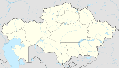
| Coordinates: 51°10′04″N 52°59′42″E / 51.16778°N 52.99500°ECoordinates: 51°10′04″N 52°59′42″E / 51.16778°N 52.99500°E | ||
| Country |
| |
| Region | West Kazakhstan Region | |
| District | Borili District | |
| Population (2009) | ||
| • Total | 32,873 | |
| Time zone | UTC+5 (UTC + 5) | |
| Area code(s) | 71133 | |

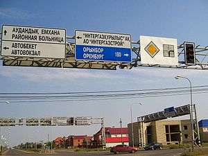
Aksay (Kazakh: Ақсай) is a town in north-western Kazakhstan. It is the administrative center of Borili District in West Kazakhstan Region. Population: 32,873 (2009 Census results);[1] 28,953 (1999 Census results).[1]
It is an important oil and gas town, serving as an operational base for the nearby Karachaganak Field.
Climate
| Climate data for Aksay | |||||||||||||
|---|---|---|---|---|---|---|---|---|---|---|---|---|---|
| Month | Jan | Feb | Mar | Apr | May | Jun | Jul | Aug | Sep | Oct | Nov | Dec | Year |
| Average high °C (°F) | −8.9 (16) |
−8.2 (17.2) |
−1.2 (29.8) |
13.6 (56.5) |
23.1 (73.6) |
27.5 (81.5) |
29.6 (85.3) |
27.8 (82) |
21.3 (70.3) |
10.4 (50.7) |
0.9 (33.6) |
−5.1 (22.8) |
10.9 (51.6) |
| Average low °C (°F) | −17.1 (1.2) |
−17.3 (0.9) |
−9.8 (14.4) |
1.9 (35.4) |
9.0 (48.2) |
13.7 (56.7) |
16.1 (61) |
14.0 (57.2) |
8.1 (46.6) |
0.7 (33.3) |
−5.6 (21.9) |
−12.4 (9.7) |
0.1 (32.2) |
| Average precipitation mm (inches) | 23 (0.91) |
18 (0.71) |
18 (0.71) |
20 (0.79) |
21 (0.83) |
37 (1.46) |
35 (1.38) |
25 (0.98) |
28 (1.1) |
31 (1.22) |
33 (1.3) |
32 (1.26) |
321 (12.64) |
| Source: Climate-data.org | |||||||||||||
References
- 1 2 "Население Республики Казахстан" (in Russian). Департамент социальной и демографической статистики. Retrieved 8 December 2013.
Capital: Oral | ||
| Districts |  | |
| Major cities and towns | ||
This article is issued from
Wikipedia.
The text is licensed under Creative Commons - Attribution - Sharealike.
Additional terms may apply for the media files.