Airag Lake
| Airag Lake | |
|---|---|
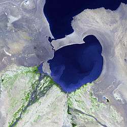 Satellite image taken from Landsat-7. | |
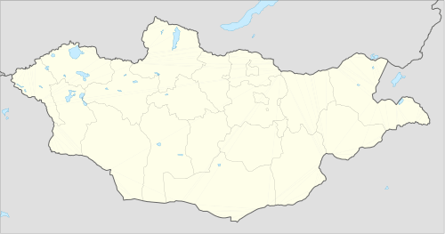
| Location | Uvs aimag, Mongolia |
| Coordinates | 48°53′N 93°25′E / 48.883°N 93.417°ECoordinates: 48°53′N 93°25′E / 48.883°N 93.417°E |
| Lake type | freshwater |
| Primary inflows | Zavkhan River, Khüngüin River |
| Primary outflows | Khyargas Lake |
| Basin countries | Mongolia, Russia |
| Max. length | 18 km (11 mi) |
| Max. width | 13 km (8.1 mi) |
| Surface area | 143.3 km2 (55.3 sq mi) |
| Average depth | 5.7 m (19 ft) |
| Max. depth | 10 m (33 ft) |
| Water volume | 819.6 m3 (28,940 cu ft) |
| Surface elevation | 1,030 m (3,380 ft) |
| Official name | Ayrag Nuur |
| Designated | 13 April 1999 |
| Reference no. | 977[1] |
Airag Lake
Airag Lake (Mongolia)
Airag Lake (Mongolian: Айраг нуур, Airag Nuur, lit. "airag") is a lake in western Mongolia in the Great Lakes Depression. It is in a system of the interconnected lakes: Khar-Us, Khar, Dörgön, and Khyargas.
The lake was in the same basin as the Khyargas Lake in ancient times.
The depth of the lake generally varies with the inflow river flow. The lake flows into Khyargas Lake along a 5 km long, 200–300 m wide canal, which does not freeze in winter.
In summer, the lake warms up almost to the very bottom. Even in winter, the temperature remains fairly constant, 1 - 2.5 °C. Compared to other lakes, the water is not very clear.[2]
References
- ↑ "Ayrag Nuur". Ramsar Sites Information Service. Retrieved 25 April 2018.
- ↑ Medeelel.mn Archived 2012-09-05 at Archive.is; Айраг нуур
This article is issued from
Wikipedia.
The text is licensed under Creative Commons - Attribution - Sharealike.
Additional terms may apply for the media files.