Aileu Municipality
| Aileu | ||
|---|---|---|
| Municipality | ||
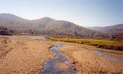 River in Aileu | ||
| ||
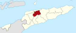 Map of East Timor highlighting Aileu Municipality | ||
| Coordinates: 8°43′S 125°34′E / 8.717°S 125.567°ECoordinates: 8°43′S 125°34′E / 8.717°S 125.567°E | ||
| Country |
| |
| Capital | Aileu | |
| Administrative posts | ||
| Area | ||
| • Total | 737 km2 (285 sq mi) | |
| Area rank | 9th | |
| Population (2015 census) | ||
| • Total | 48,837 | |
| • Rank | 12th | |
| • Density | 66/km2 (170/sq mi) | |
| • Density rank | 8th | |
| Households (2015 census) | ||
| • Total | 7,598 | |
| • Rank | 13th | |
| Time zone | UTC+09:00 (TLT) | |
| ISO 3166 code | TL-AL | |

Aileu (Portuguese: Município Aileu, Tetum: Munisípiu Aileu) is a municipality, and was formerly a district, of East Timor. It has a population of 48,554 (Census 2015) and an area of 737 km².[1] The municipality's capital is also named Aileu. Its administrative posts are Aileu Vila, Laulara, Lequidoe and Remexio.
Etymology
The word Aileu means "bent tree" in the local Mambai language.[2]
Geography
Aileu is in the northwestern part of East Timor and is one of only two landlocked municipalities, the other being Ermera. It borders Dili to the north, Manatuto to the east, Manufahi to the southeast, Ainaro to the south, Ermera to the west, and Liquiçá to the northwest. It was formerly part of what is now the municipality of Dili but was split in the final years of Portuguese administration.
Politics
As part of the Timor-Leste Government decentralization program the former District of Aileu is now organised as the Municipality of Aileu, headed by a Municipal Administrator. The four former subdistricts are now organised as Administrative Posts.
Administrative posts
The municipality's administrative posts (formerly sub-districts) are:[3]
Development
Aileu is the focus of several development programmes from NGOs, including WaterAid,[4] World Vision[5] and Plan International.[6] In May 2000 the Hume City Council and Moreland City Council and the communities in Melbourne Australia, established a friendship relationship with the Aileu Municipality, called "Friends of Aileu". The friendship relationship has been renewed periodically, with the signing of updated Friendship Agreements in 2005, 2010 and 2016.[7] and [8]
References
- ↑ http://www.statistics.gov.tl/preliminary-results-population-and-housing-census-2015/
- ↑ Hull, Geoffrey (June 2006). "The placenames of East Timor" (PDF). Placenames Australia: Newsletter of the Australian National Placenames Survey: 6–7. Archived (PDF) from the original on 14 February 2017. Retrieved 4 June 2018.
- ↑ Gunn, Geoffrey C (2011). "Aileu District". Historical Dictionary of East Timor. Lanham, Maryland: Scarecrow Press. p. 36. ISBN 9780810867543.
- ↑ "{title}". Archived from the original on 2012-09-18. Retrieved 2010-10-07.
- ↑ http://timorleste.wvasiapacific.org/index.php?option=com_content&view=section&id=13&Itemid=95
- ↑ http://www.plan.org.au/ourwork/asia/easttimor/water-sanitation-hygeine
- ↑ "{title}". Archived from the original on 2011-02-20. Retrieved 2010-10-07.
- ↑ https://www.facebook.com/friendsofaileu/
External links
![]()