Pyramid Peak (Montana)
| Pyramid Peak | |
|---|---|
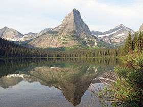 Pyramid Peak, as seen from Glenns Lake. | |
| Highest point | |
| Elevation | 8,159 ft (2,487 m) [1] |
| Coordinates | 48°52′24″N 113°49′53″W / 48.87333°N 113.83139°WCoordinates: 48°52′24″N 113°49′53″W / 48.87333°N 113.83139°W [1] |
| Geography | |
 Pyramid Peak Glacier County, Montana, United States | |
| Parent range | Lewis Range |
| Topo map | USGS Ahern Pass, MT |
Pyramid Peak (8,159 feet (2,487 m)) is in the Lewis Range, Glacier National Park in the U.S. state of Montana. Mokowanis Lake lies just northeast of the peak, and Atsina Lake is to the west.[2]
See also
References
- 1 2 "Pyramid Peak". Geographic Names Information System. United States Geological Survey. Retrieved 2010-07-03.
- ↑ "Ahern Pass, MT" (Map (USGS Quad)). TopoQuest. Retrieved 2011-01-29.
This article is issued from
Wikipedia.
The text is licensed under Creative Commons - Attribution - Sharealike.
Additional terms may apply for the media files.