Adimali
| Adimaly | |
|---|---|
| Town | |
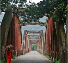
 Aerial view of Adimaly town | |
 Adimaly Location in Kerala, India  Adimaly Adimaly (India) | |
| Coordinates: 10°00′53″N 76°57′22″E / 10.0147600°N 76.956139°ECoordinates: 10°00′53″N 76°57′22″E / 10.0147600°N 76.956139°E | |
| Country |
|
| State | Kerala |
| District | Idukki |
| Talukas | Devikulam |
| Area | |
| • Total | 340.88 km2 (131.61 sq mi) |
| Elevation | 650 m (2,130 ft) |
| Population | |
| • Total | 40,593 |
| • Density | 120/km2 (310/sq mi) |
| Languages | |
| • Official | Malayalam, English |
| Time zone | UTC+5:30 (IST) |
| PIN | 685561 |
| Telephone code | 04864 |
| Vehicle registration | KL-68 |
| Nearest city | Kothamangalam, Munnar |
| Lok Sabha constituency | Idukki |
| Vidhan Sabha constituency | Devikulam |
| Sex ratio | 1005 ♂/♀ |


Adimaly is a town in the Idukki district of Kerala, India.[1] National Highway 185 (NH 185) is a highway in India running from Adimali to Kumily through Kattappana and ends in Adoor in Kerala.[2] Adimaly is located on the National Highway 49,now NH 85,known as Kochi -Dhanushkodi national highway(India) connecting Kochi and Madurai, India. From Adimaly, it is only 27 kilometers to Munnar, which is a famous hill station.[3] The waterfalls Cheeyappara, Adimaly waterfalls and Valara are located nearby. Pepper cultivation is the main agricultural activity of this place.[4] The Ponmudi Dam (294 meter length) was constructed in 1963 across the Panniar river, nearly 15 km southeast of Adimali, on the way to Rajakkad. Adimali is known for its proximity to munnar and natural environment. Adimaly has almost all the basic facilities like roads, educational institutions and hospitals.
The former name of the Adimaly area was Mannamkandam, as the name indicates the Mannan tribe once populated the area. Other tribal groups collectively called the Muthuvan were also living in Adimali. Before 1980, the main crops under cultivation were rice as well as pepper and cardamom. Now almost 90 percent of the paddy fields have been modified for other purposes such as residential land, rubber plantations or banana fields.
History
Adimali is a relatively new town located between Kochi and Munnar. It gained its importance when the Government of Kerala allowed mass settlements of people from the neighbouring districts in the Mid 20th century. The majority of the people in area around Adimali migrated from the nearby district of Ernakulam. Since it intersects two major roads and is a popular resting point on the way to Munnar, Adimali slowly grew in size. In the last 15 years, Adimali has emerged as a major population center in the district.
Adimaly is a small town in Idukki district of Kerala state, India. It is part of Idukki township. Adimaly is located on the National Highway 49 connecting Kochi and Madurai. Munnar -a hill station- is about 30 km from Adimaly. The Cheeyappara and Valara waterfalls are located en route to Adimaly. Pepper is the major cultivation in this area. Ponmudi Dam, which is constructed across the Panniar river, is about 15 km from Adimali, on the way to Rajakkad. The dam which was built in 1963 has a length of 294 m. The places nearby to this area are Kuthirayalla, Pettimudi, and Maankulam. Pettimudi area is near to Tamil Nadu.
Adimali for decades served as a commercial hub for many smaller towns nearby such as Kunjithanny, Anachal, Rajakkad, Shanthanpara, Vellathoval, Murikkassery, Thopramkudi, Panikkankudi, Kallarkutti etc. However, the reliance on Adimali by these smaller towns faded during the years due to development of adequate roads and other infrastructure, few have emerged as self-reliant commercial townships.
Geography
Adimaly is located in an area with several waterfalls, valleys and hills. It is known for its pepper and cardamom plantations. The area also has a few dams and adjoining man-made reservoirs.
Cheeyappara Waterfall
The rapids of Cheeyappara descend from a height of about 1000 feet, churning with force onto 13 rock slabs in the vicinity of a bridge on National Highway 49. It is one of the few waterfalls one can view from the bottom, standing so close to the water. Next to the falls, there is a designated bathing area.
Valara Waterfall
Valara Waterfall is another 1 kilometer from Cheeyapara waterfall en route to Adimaly. One of the tributaries of The Periyar River cascades steeply from the top of a hill to a depth of about 200 feet, into a gorge.
Adimaly Waterfall

Near the centre of Adimali township, an eponymous waterfall has become an attraction and landmark, accessible from the town.
Climate
Adimaly generally has a cool climate throughout the year, typical of the higher altitudes, though not as cold as Munnar. Temperatures rarely exceed 26 degrees and never drop below 10 degrees as it usually stays around 17-24 degrees. Though December–January are comparatively cooler than other months. Adimaly is a place with heavy rainfall mostly throughout the year and it is heaviest during the June–September season of southwest monsoon. Rains in Adimaly sometimes continue for hours or even days without any dry spell, which may bring the town to a standstill. New residents frequently relocate to Adimaly, owing to its atmosphere and surroundings. This is evident considering the abrupt increase in population both within the town and nearby areas in the recent past.
Trade and commerce
Historically, this area's economy has depended heavily upon agriculture. Adimaly produces a high percentage of Kerala's total domestic production of spices and is an important spice trading center. Industry and secondary development has seen moderate growth, and does not play a pivotal role in the economy. The service sector comprises a very small section of the town's economy.
Education
Colleges
- Mar Baselious College
- SNDP Yogam Training College
- Stella Maries College
- Carmelgiri College
- Logos Academy
- Morning Star School of Nursing
Schools
- GOVERNMENT TECHNICAL HIGH SCHOOL ADIMALI
- Adimali Gov.High School
- Sree Vivekananda Vidhyasadan English Medium School
- SNDP Yogam High School
- Eastern Newton Public School
- Viswadeepthi Public school
- St. Tomas Public school
- Fathima matha girls higher secondary School
- Hira Balakendra school
(for LKG & UKG kids)
- Carmel Matha High School Mankadavu
Places of worship
- MANKADAVU DEVI TEMPLE
- SREE BHAGAVATHY VAISHNAVA MAHADEVA TEMPLE, ADIMALY
- Santhi Giri Sri Mahadeva Temple,Adimaly
- Chattupara temple
- 100 acre , kallambalam temple
- 200 acre , temple
- Mar Ignathious Noorono Jacobite Syrian Church, 14th mile, Adimaly
- St. George Church Jacobite Syrian Cathedral,Adimaly
- St. Jude Catholic Town Church
- St Martin de Pores Latin Catholic Church
- St.Peter's & St. Paul's Jacobite Syrian Aramana Church,Adimaly
- St. Thomas Orthodox Church,Adimaly
- Town Jumah Masjid, Adimaly
- Hira Jumua Mosque
- Kallambalam Temple Ayiram Acre
- Sree Subramanya Swami Temple Ayiram Acre
- Mankaduvu Devi Temple
- Salafi Mosque, Irumpupalam
- St. George Church Jacobite Syrian Church,Koompanpara
- Fathima Matha Forane Church, Koompanpara
- Infant Jesus church, mankadavu
- St. George Church Jacobite Syrian Church,1000 acre
- St.George Jacobite Syrian Church Machiplavu
- St.Franscis Assisi catholic church Machiplavu PO
- Town Jumah Masjid Irumpupalam
- Central Jumah Masjid, Irumpupalam
- Jumah Masjid, 10th mile
- Sharon Fellowship Church, Campco Junction, Adimaly
- St. Johns CSI church chattupara
- The Pentecostal mission (TPM), 200 acre
References
| Wikimedia Commons has media related to Adimaly. |
- ↑ "Yahoo Maps India :Adimaly, Idukki Township, Idukki, Kerala". Archived from the original on 14 January 2009. Retrieved 2009-01-13.
- ↑ Archived 10 April 2009 at the Library of Congress Web Archives Start and end points of National Highways-Source-Government of India
- ↑ "Kerala tourism". Retrieved 2013-10-10.
- ↑ "Adimali". Archived from the original on 7 January 2009. Retrieved 2009-01-13.