Abu Tig
| Abu Tig أبو تيج | |
|---|---|
 | |
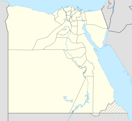 Abu Tig Location in Egypt | |
| Coordinates: 27°02′12″N 31°19′41″E / 27.03667°N 31.32806°E | |
| Country |
|
| Governorate | Asyut |
| Time zone | UTC+2 (EST) |
Abu Tig (Arabic: أبو تيج; Coptic: Ⲧⲁⲡⲟⲟⲩⲕⲏ[1]) is a city in the Asyut Governorate of Egypt. Located on the west bank of the Nile, it has a population of 70,969 inhabitants (2006).
Abu Tig is the third largest city in Asyut Governorate in Egypt after Asyut itself and Dairut. It is not only a commercial city but is famous for El Farghal Mosque as well. El Farghal Mosque, with its twin minarets, is the largest mosque in Upper Egypt. Many people come to Abu Tig every year in July to visit El Farghal Mosque and celebrate at the El Farghal fair.[2] During holidays and feasts, people from all over Upper Egypt come to Abu Tig to visit its zoo, called "Nasser Zoo".
History
Abu Tig is an ancient city distinguished by its ancient-times archaeology, including an obelisk with a depiction of Queen and Pharaoh Hatshepsut.[3] Palaces and churches in Abu Tig date back to ancient Coptic,[4][5] and Islamic eras. During the Napoleonic Era, tourists looking for fine belly-dancing could find belly-dancers in Abu Tig. A school for training belly-dancers existed there until public belly-dancing was banned. [6] In the early 19th century slaves from Sudan were castrated near Abu Tig, mainly by Coptic priests.[7] Abu Tig has a number of bars that cater to tourists, including divers.[8]
Geography
Abu Tig has many subordinate villages like: Baqor, Nazlat Baqor, El Felio, El Nekhila, Bani Semei, El Zayara, El Zawia, Dekran, El Zarabi, Dweina, Nazlat Dweina, Abu El Hareth, Abu Khors and El Balayza.
Climate
Abu Tig is classified by Köppen-Geiger climate classification system as hot desert (BWh),[9] as the rest of Egypt.
| Climate data for Bilbeis | |||||||||||||
|---|---|---|---|---|---|---|---|---|---|---|---|---|---|
| Month | Jan | Feb | Mar | Apr | May | Jun | Jul | Aug | Sep | Oct | Nov | Dec | Year |
| Average high °C (°F) | 20.7 (69.3) |
22.8 (73) |
27.1 (80.8) |
32.2 (90) |
35.9 (96.6) |
37.5 (99.5) |
37.2 (99) |
37.1 (98.8) |
34.1 (93.4) |
31.0 (87.8) |
27.1 (80.8) |
22.2 (72) |
30.4 (86.8) |
| Daily mean °C (°F) | 13.3 (55.9) |
14.9 (58.8) |
18.5 (65.3) |
23.2 (73.8) |
27.3 (81.1) |
29.4 (84.9) |
29.5 (85.1) |
29.7 (85.5) |
27.4 (81.3) |
24.6 (76.3) |
19.8 (67.6) |
15 (59) |
22.7 (72.9) |
| Average low °C (°F) | 6 (43) |
7 (45) |
9.9 (49.8) |
14.3 (57.7) |
18.7 (65.7) |
21.4 (70.5) |
21.9 (71.4) |
22.4 (72.3) |
20.8 (69.4) |
18.2 (64.8) |
12.6 (54.7) |
7.8 (46) |
15.1 (59.2) |
| Average precipitation mm (inches) | 0 (0) |
0 (0) |
0 (0) |
0 (0) |
0 (0) |
0 (0) |
0 (0) |
0 (0) |
0 (0) |
0 (0) |
1 (0.04) |
1 (0.04) |
2 (0.08) |
| Source: Climate-Data.org[9] | |||||||||||||
Coordinates: 27°02′12″N 31°19′41″E / 27.03667°N 31.32806°E
References
- ↑ https://st-takla.org/books/pauline-todary/coptic-language/egyptian.html
- ↑ "About Asyut City area and location". aun edu. Asyut University.
- ↑ Rebecca Angharad Dean (31 March 2017). Warfare and Weaponry in Dynastic Egypt. Pen and Sword. pp. 127–. ISBN 978-1-4738-6205-0. Archived from the original on 26 November 2017.
- ↑ Otto F. A. Meinardus (1 September 2006). Christians In Egypt: Orthodox, Catholic, and Protestant Communities - Past and Present. American University in Cairo Press. pp. 47–. ISBN 978-1-61797-262-1. Archived from the original on 26 November 2017.
- ↑ Sami A. Hanna (1 January 1972). AZIZ SURYAL ATIYA. Brill Archive. pp. 322–. ISBN 90-04-03406-4. Archived from the original on 26 November 2017.
- ↑ Kathleen W. Fraser (25 November 2014). Before They Were Belly Dancers: European Accounts of Female Entertainers in Egypt, 1760–1870. McFarland. pp. 53–. ISBN 978-1-4766-1916-3. Archived from the original on 26 November 2017.
- ↑ Mariam Ayad (2 May 2016). Studies in Coptic Culture: Transmission and Interaction. American University in Cairo Press. pp. 132–. ISBN 978-1-61797-766-4. Archived from the original on 26 November 2017.
- ↑ Fodor's (2011). Fodor's Egypt. Fodor's Travel Publications. pp. 377–. ISBN 978-1-4000-0519-2. Archived from the original on 2017-11-26.
- 1 2 "Climate: Abu Tig - Climate graph, Temperature graph, Climate table". Climate-Data.org. Retrieved 25 November 2017.