1942 Guatemala earthquake
 | |
| UTC time | 1942-08-06 23:37:02 |
|---|---|
| ISC event | 900408 |
| USGS-ANSS | |
| Local date | August 6, 1942 UTC |
| Local time | 17:37 |
| Magnitude |
Mw 7.7 [1] Ms 7.9 [2][3] |
| Depth | 35 km (22 mi) |
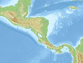
| Epicenter | 13°47′N 90°55′W / 13.78°N 90.91°WCoordinates: 13°47′N 90°55′W / 13.78°N 90.91°W |
| Areas affected | Guatemala |
| Casualties | 38 killed |
The 1942 Guatemala earthquake occurred at 17:37 local time on August 6 and had ratings of 7.7 on the moment magnitude scale and 7.9 on the surface wave magnitude scale. The epicenter was located off the southern coast of Guatemala,[4] and it was one of the strongest earthquakes ever recorded there.
The earthquake caused widespread damage in the west-central highlands of Guatemala. Thirty-eight people died in the earthquake. Landslides caused by the combination of the earthquake and the heavy seasonal rains destroyed roads, the Inter-American Highway, and telegraph lines. In Tecpán Guatemala, more than 60% of the houses were demolished. Damage was reported in some buildings in Antigua Guatemala, including the Palacio de Los Capitanes Generales and some catholic churches.[5][6] The earthquake could also be felt strongly in Mexico and El Salvador.[7]
This earthquake was a lower crustal intraplate earthquake with a compressional focal mechanism.[3][8] Tensional activity has been dominant along the down-dip edge along the 1942 rupture zone.[9] It was estimated that earthquakes near the Middle America Trench with magnitudes of about 7.5~8.0 occurred at intervals of 94 ± 54 yrs in southwestern Guatemala. Such historical earthquakes included the earthquakes in 1765, 1902, and 1942.[10]
See also
References
- ↑ Engdahl, E. R.; Vallaseñor, A. (2002), "Global seismicity: 1900–1999", International Handbook of Earthquake & Engineering Seismology (PDF), Part A, Volume 81A (First ed.), Academic Press, p. 678, ISBN 978-0124406520
- ↑ Dmowska & Lovison 1988, p. 657
- 1 2 Astiz, Luciana; Kanamori, Hiroo (1984), "An earthquake doublet in Ometepec, Guerrero, Mexico" (PDF), Physics of the Earth and Planetary Interiors, Elsevier, 34 (1–2): 41, Bibcode:1984PEPI...34...24A, doi:10.1016/0031-9201(84)90082-7, archived from the original (PDF) on 2010-07-23, retrieved 2012-08-04
- ↑ Monzón-Despang, Héctor (February 1996), La construcción y el uso del terreno en Guatemala : Su vulnerabilidad sísmica (PDF), Asociacion Guatemalteca de Ingenieros Estrucurales, pp. 107–121, retrieved August 3, 2012
- ↑ ABC (August 11, 1942). "Mundo Hispanoamericano – Fuerte seísmo en Guatemala. Ocho muertos y cuarenta heridos". ABC. p. 17. Retrieved August 3, 2012.
- ↑ "Sismología". Instituto Nacional de Sismología, Vulcanología, Meteorología e Hidrología. Retrieved August 3, 2012.
- ↑ "Historic Earthquakes — Guatemala, 1942 August 06 23:36 UTC". United States Geological Survey. Retrieved August 3, 2012.
- ↑ Dmowska & Lovison 1988
- ↑ Lay, Thorne; Astiz, Luciana; Kanamori, Hiroo; Christensen, Douglas (1989). "Temporal variation of large intraplate earthquakes in coupled subduction zones" (PDF). Physics of the Earth and Planetary Interiors. Elsevier. 54 (3–4): 273. Bibcode:1989PEPI...54..258L. doi:10.1016/0031-9201(89)90247-1.
- ↑ White, Randall A.; Ligorría, Juan Pablo; Cifuentes, Ines Lucia (2004). "Seismic history of the Middle America subduction zone along El Salvador, Guatemala, and Chiapas, Mexico: 1526–2000". GSA Special Papers. Geological Society of America. 375: 379–396. doi:10.1130/0-8137-2375-2.379. ISBN 0-8137-2375-2.
Sources
- Dmowska, Renata; Lovison, Lucia C. (1988), "Intermediate-term Seismic Precursors for Some Coupled Subduction Zones" (PDF), Pure and Applied Geophysics, Springer Science+Business Media, 124 (2–4): 643–664, Bibcode:1988PApGe.126..643D, doi:10.1007/bf00879013
External links
- The International Seismological Centre has a bibliography and/or authoritative data for this event.