Șura Mică
| Șura Mică | |
|---|---|
| Commune | |
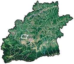 Location of Șura Mică | |
| Coordinates: 45°49′55″N 24°3′27″E / 45.83194°N 24.05750°ECoordinates: 45°49′55″N 24°3′27″E / 45.83194°N 24.05750°E | |
| Country |
|
| County | Sibiu County |
| Status | Commune |
| Government | |
| • Mayor | Marcu Mircea Dorel (Democratic Party) |
| Area | |
| • Total | 49.48 km2 (19.10 sq mi) |
| Population (2002) | |
| • Total | 2,360 |
| Time zone | UTC+2 (EET) |
| • Summer (DST) | UTC+3 (EEST) |

Fortified church of Șura Mică
Șura Mică (German: Kleinscheuern; Hungarian: Kiscsűr) is a commune in the central part of Sibiu County, Romania. The commune is located immediately to the north of the city of Sibiu. It is composed of two villages, Rusciori (Reußdörfchen; Oroszcsűr) and Șura Mică.
Population
- 1525: a school
- 1786: 613 people
- 1910: 1412 people
- 1990: 2550 people
History
The village was documented in 1323 as "Parvum Horreum" = Kleine Scheuer.[1]
A medieval fortified church in Șura Mică was built in the 13th century and considerably rebuilt around 1500. Only fragments of the surrounding wall survive.[1]
The village is known for the colorful "Trachten" of the traditional Saxon population dress for women and girls.
Agricultural centre: farming, livestock, hops, fruits.
Name changes: Cleynschowern (ca. 1468).
References

This article is issued from
Wikipedia.
The text is licensed under Creative Commons - Attribution - Sharealike.
Additional terms may apply for the media files.